This route is distributed in association with Sheffield Lakeland Landscape Partnership
Description
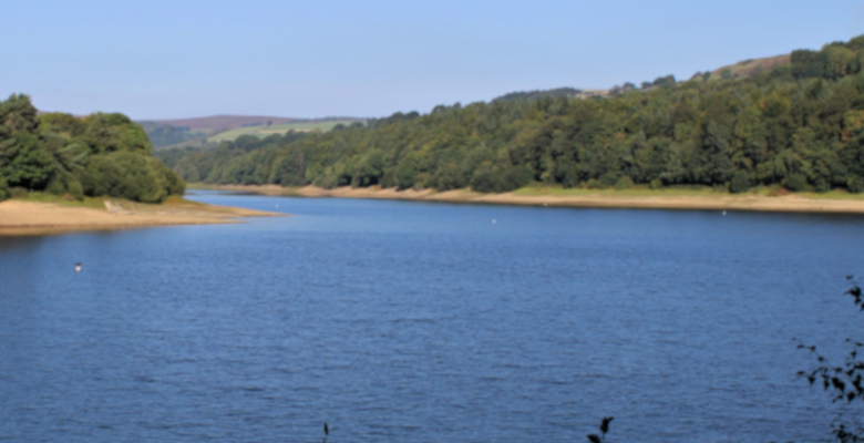
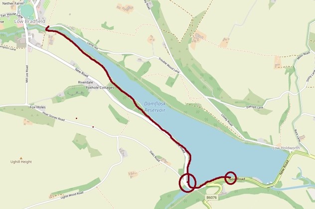
A woodland route with great views across Damflask Reservoir towards the surrounding hills. The route follows the south shore of the reservoir, through woods and then along the edge of fields, crossing the river just outside Low Bradfield. The path is generally flat and 1.5 m wide, with some short gentle gradients and narrower sections.
A road goes between our inclusive route on the north side of the reservoir and our inclusive route on the south side. It is fairly narrow, has traffic going in both directions, and the edges on either side are soft. Using this stretch of road is not recommended.
Information
- Length – 1.5 miles
- Time – 30/40 minutes one way
- Start – Damflask Lodge, B6076 or use the entrance to the route on the B6076 between the Dungworth and Ughill turn-offs.
- Grid Reference – SK 284 905
- Parking – Either: park at Damflask Lodge on the B6076. A few metres to your left is the start of the route along the side of the reservoir. There is a dropped kerb at the lodge and for 20 m along the road the kerb is low enough for wheelchair access.
Or: park just past the bus stop on the road along the south side of the reservoir between the turn-off to Dungworth and the turn-off to Ughill, where there is space for two or three cars, and no kerb. Cross the road to reach the entrance to the route along the side of the reservoir.
- Public transport – 62 bus from Hillsborough to the stop on B6076 between the Dungworth and Ughill turn-offs. Cross the road to reach the entrance to the route along the side of the reservoir.
- Refreshments – The Schoolrooms Café is wheelchair accessible. (Mill Lee Road, Low Bradfield, S6 6LB, phone 0114 285 1920).
- Accessible public toilets – Low Bradfield, next to parish council offices, radar key access. The Schoolrooms café also has an accessible toilet.
- Seating – there are benches approximately every 200 m.
Download the route information and gpx data
Map of the route
Mobile Phone Coverage – Mobile phone signal coverage is mostly good in this area. Intermittent signals can be received on higher ground.
Ordnance Survey map OL1 Dark Peak is recommended for all the routes on this web site.
Great care has been taken to ensure that the information on this web site and associated documents is accurate. However, we accept no liability for any claim, loss, damage or injury (howsoever arising) incurred by those using the information provided. Except where expressly stated to the contrary, copyright in the text, graphics and information contained in this web site (including downloads) is owned by Bradfield Walkers are Welcome. You may print, or download to a personal computer, extracts for personal use. Permanent copying and/or storage of whole or part of this web site or the information contained therein or reproduction or incorporation of any part of it in any other work or publication whether paper or electronic media or any other form is expressly prohibited unless agreed otherwise.
Copyright – Stocksbridge Walkers are Welcome 2020