This route is distributed in association with Sheffield Lakeland Landscape Partnership
Description
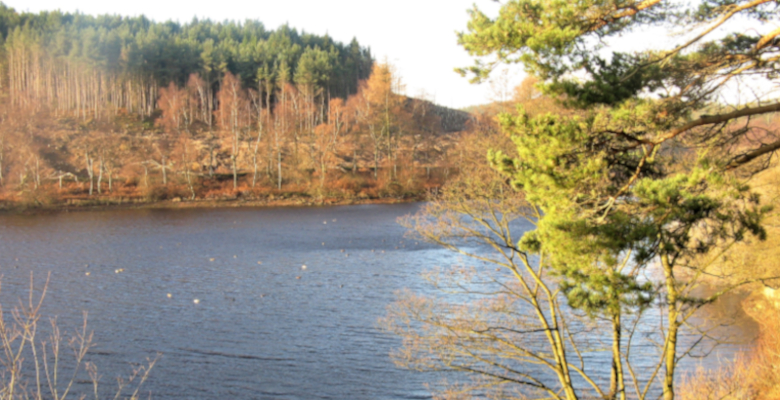
An inclusive circular lakeside route, acessible to wheelchair users and buggies, through larch woods, opening out into deciduous woodland. There are views southwest across the water to the moors. The off-road path is between 1.5 and 2.5 m wide and generally flat, with some short gradients
Information
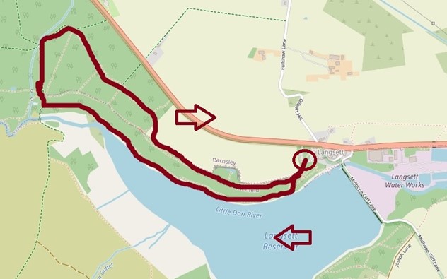
- Length – 2.4 miles (3.8 km) in total (outwards and return)
- Time – 50 minutes (at 20 minutes per mile)
- Start – Langsett Barn car park, Langsett village (Yorkshire Water Services Ltd., Langsett Barn, S36 4GY)
- Grid Reference – SE 212 005
- Parking – Langsett Barn car park. Parking is free. There are reserved parking bays for people with disabilities.
- Public transport – the route is not accessible by public transport
- Accessible Refreshments
- Bank View Café, Langsett, S36 4GY is wheelchair accessible. It is approximately 200 m from Langsett Barn car park, towards Stocksbridge, on the other side of the A616. There is a path from the car park towards the café, but there is no dropped kerb to allow wheelchair users to cross the road. The café has a car park. Phone: 01226 762 337.
- numerous refreshment options at Fox Valley Retail Park (Stocksbridge).
- Accessible Toilets –
– Langsett Barn, open dawn to dusk. This is next to the car park, down a short, paved slope with a handrail on one side.
– Brearley House, Fox Valley Retail Park. This is near the front entrance to the retail park. Take the lift to the first floor and follow the hallway round to the right.
- Seating – Along the route, there are benches approximately every 200 m. There is also seating at Fox Valley Retail Park
Download the route information and gpx data.
Map of the route
Mobile Phone Coverage – Mobile phone signal coverage is mostly good in this area. Intermittent signals can be received on higher ground.
Ordnance Survey map OL1 Dark Peak is recommended for all the routes on this web site.
Great care has been taken to ensure that the information on this web site and associated documents is accurate. However, we accept no liability for any claim, loss, damage or injury (howsoever arising) incurred by those using the information provided. Except where expressly stated to the contrary, copyright in the text, graphics and information contained in this web site (including downloads) is owned by Bradfield Walkers are Welcome. You may print, or download to a personal computer, extracts for personal use. Permanent copying and/or storage of whole or part of this web site or the information contained therein or reproduction or incorporation of any part of it in any other work or publication whether paper or electronic media or any other form is expressly prohibited unless agreed otherwise.
Copyright – Stocksbridge Walkers are Welcome 2020